

New global index enables live transit benchmarking
A new interactive benchmarking platform has been launched, enabling transport authorities and operators to compare first-stop on-time performance across more than 1,000 locations worldwide using open data from the most recent 28-day period.
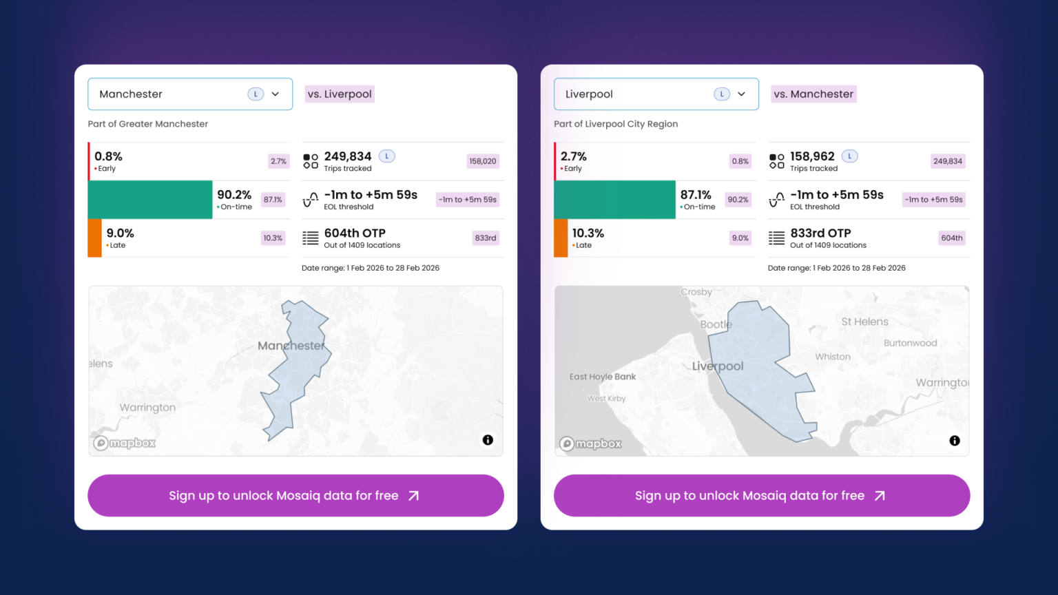
The Mosaiq Global Public Transit Index aggregates publicly available feeds into a single interface that allows side-by-side comparison between cities, regions and countries.
The platform replaces static reports with a rolling, regularly updated view of performance. Users can examine early, on-time and late running percentages and see how those metrics differ depending on local policy definitions.
Miki Szikszai (pictured), CEO, Snapper Services, told Cities Today that the initiative was developed in response to limitations in traditional benchmarking approaches and the fragmented nature of existing comparisons.
“The data that they’re working with is often really stale and it lacks context,” he said. “You can go to lots of sites and you can see a point in time where someone says, in 2024 here’s how our network performed, and that’s not really that helpful if you want to have really good context around how you’re performing, who your peers are, and how you can maybe take the next step.”
The index enables agencies to explore performance across hundreds of jurisdictions using the same underlying framework. It is intended to help leaders understand how their networks compare and identify potential peers for further analysis.
“We’re able to show data for February for close to 1,400 locations around the world, so you can explore and compare and work out actually how you’re doing, who you can learn from and what the next step might look like.”
A central feature of the platform is the visibility it gives to policy settings that shape punctuality metrics. Thresholds for early, on-time and late services differ significantly between countries and regions.
“There’s usually a window that’s used to define what is early, what is on time, what is late,” Szikszai said. “That varies around the world. Even being able to compare policy settings is really important.”
Szikszai said transport executives should begin by examining their own network before expanding outward to comparable peers. The objective is to identify systems operating under similar constraints rather than defaulting to headline international examples.
“They should look at their own city or location or country, and then they should just explore,” he said. “Start to get a sense of, actually, who might I learn from?”
He cautioned against drawing conclusions from headline performance figures without understanding structural differences.
“One of the stories I always hear is someone goes overseas and comes back saying, you should look at Tokyo, their public transport is amazing,” he commented. “But they won’t necessarily have that context of being able to even look at Tokyo and say, yes, Tokyo is amazing, but they have the narrowest on-time performance window in the world.”
The platform reflects only open data that has been published by authorities and operators. Where data is not available, the absence is visible within the summary results.
“If the train data is there, then we will be surfacing that,” he said. “If the data is not published as open data, then it will not appear at that summary level.”
In the UK, Szikszai said levels of open data maturity differ significantly between regions. Referring to London, he highlighted the gap between operational performance and publicly available datasets.
“One of the things that’s fascinating about London is it’s usually held up as a real paragon,” he added. “It does perform well, we know from closed data that we can see, but the open data is really weak. That’s because of the old iBus technology that they have there. They’ve got to do quite a bit of work on their infrastructure there to kind of lift it to the same level as other regions around the UK.”
Access to the index does not require registration and is positioned as an open resource for the sector.
“They don’t even need to log in,” he said. “This is open and free to use for everyone in terms of the index, because we think it really needs to be something that is a wide resource.”
Szikszai described the scale and openness of the dataset as distinctive in the market.
“We think this is a world first,” he added. “I don’t think there is anything anywhere that has this amount of data available for this many locations that is open and free.”
Images: Snapper Services