
Tag Archive for: parking policy

Boston launches Curb Lab to digitise and coordinate kerb space

Boston is deploying artificial intelligence and open data to bring real-time visibility to one of the most complex and contested parts of the street–the kerb.

The City of Boston has launched the Curb Lab, a cross-department initiative led by the Office of Emerging Technology to create and maintain a live digital understanding of parking regulations and build tools that help residents navigate them. The programme is designed to dynamically manage kerb space, reduce congestion and improve accessibility across the city.

For Michael Lawrence Evans, Director, Office of Emerging Technology, the drivers behind the initiative span multiple operational pressures.

“All of the above,” he told Cities Today, when asked what specific operational problem made the Curb Lab a priority–congestion, enforcement gaps, safety risks, or fragmented data. “Consider how often we rely on, use, or need information about a kerb where you live–the kerb is central to advancing our transportation planning challenges.”

Evans said the advent of rideshare, e-commerce delivery, more drivers in Boston than five years ago, and a continued commitment for accessibility have fundamentally changed kerb activity over the past decade. While the Curb Lab represents a new and focused solution, he stressed it builds on Boston’s historical effort to improve parking and kerb usage.

The initiative has been made possible by recent investments in the City of Boston’s technology stack. Three years ago, Boston stood up its own asset management platform, creating a live database of every sign in the city. Over the last year and a half, SMART grant funding from the US Department of Transportation enabled the city to build AI tools that leveraged that sign data to produce a digital kerb map.

“These technological developments set the stage for the Curb Lab; and create new opportunities for the City of Boston to share information, solve problems, and serve our residents,” Evans said.

The Curb Lab will convert hundreds of years of parking rules and historical information into a citywide digital map of parking regulations. With a publicly accessible database, residents will be able to quickly and reliably answer a simple question: can I park here?

Success will be measured not only by launching the platform, but by measurable improvements in accessibility and traffic flow. Evans said the team is developing new approaches to capturing metrics, many of which have never been reliably recorded before, and is exploring more privacy-preserving technologies alongside existing camera-based solutions.

“We see accessibility as a result of good kerb productivity: high occupancy rates with high turnover rates,” he said. “We want as many people to get as close to their destination as possible, but once occupancy creeps too high up and we see dwell times and dwell time violations rise, that’s when traffic becomes impacted.”

To improve traffic flow, the city will focus on behaviours known to reduce it, including cruising, double-parking events, idling minutes and lane minutes blocked, alongside measures such as traffic volumes and average signal control delay.

The initiative has also required governance changes to connect historically siloed kerb and parking systems. Boston established a Curb Coordination Committee and leveraged its open data portal to prototype and build foundational components before bringing stakeholders into later-stage discussions.

“This is where things get really exciting–and it goes well beyond the kerb,” he said. “Because kerb management is inherently multi-modal, building this foundation opens the door to thinking much more holistically about a city’s mobility challenges, including safety.”

He added that better access to kerb information could fundamentally shift how residents experience public infrastructure, moving the relationship “from anxiety and defensiveness–worrying about tickets and towing–to trust and confidence navigating public space.”

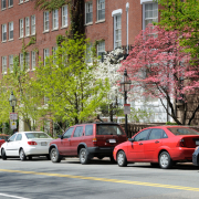
Image: Jorge Salcedo | Dreamstime.com

Former San Francisco transport strategy chief joins Cities Today Institute

The Cities Today Institute (CTI) has appointed Jonathan Rewers (pictured) as Director of Mobility for North America, strengthening its senior mobility leadership as cities across the region face mounting pressure to deliver transport reform amid rapid technological change and funding constraints.

Rewers brings nearly three decades of experience in city government, including more than 15 years at the San Francisco Municipal Transportation Agency (SFMTA), where he most recently served as Chief Strategy Officer.

In his new role, he will support agendas, provide strategic direction, and moderate the Institute’s North America mobility meetings, working closely with senior city officials and industry partners.

For Rewers, the move reflects a belief that cities need spaces where leaders can step back from day-to-day pressures and confront the scale of change reshaping urban transport, while staying focused on delivery rather than theory.

“Cities are where the world changes,” he said. “We’re in a period where cities need to be beyond the minimum expectation that the status quo is okay. The minimum expectation should be that we move at the pace of change.”

Rewers sees the Cities Today Institute as a rare forum where cities can step away from modal silos and engage in practical, cross-cutting discussions about how transport systems function.

Through closed-door meetings and peer networks, the Institute convenes senior city leaders and industry partners with a shared focus on implementation.

“When we focus on public transport alone, or safety alone, or freight alone, we end up disappointing,” Rewers said. “Everything is interconnected.”

His ambition in the role is to help city leaders not only share ideas but understand how to implement them within complex political and institutional environments.

“Every time I participated in these discussions, I walked out with a brand-new idea,” he said. “What I want to bring is not only generating those ideas but talking about how you actually achieve them.”

Learning from disruption, not resisting it

Rewers’ outlook has been shaped less by abstract strategy than by proximity to disruption. His career at SFMTA coincided with a period when San Francisco found itself repeatedly at the forefront of global mobility change, often before other cities had time to react.

“I could see the headquarters of Uber from the window of my office,” he said. “I saw what that did to the taxi industry. I saw scooters show up from nowhere. I saw micromobility show up.”

Ride-hailing platforms scaled rapidly. Dockless e-scooters appeared on pavements almost overnight. Private commuter buses, delivery services and early autonomous vehicle pilots blurred long-standing boundaries between public and private transport. The speed and visibility of change forced city officials to respond in real time, often without established playbooks.

“We were so afraid of the rapid change, we tried to slow it down to our pace,” Rewers said. “What I learned over time is that we need to join the rapid pace of change.”

That experience now underpins how he thinks about leadership in cities more broadly. While innovation is unavoidable, Rewers cautions against focusing on the new at the expense of the fundamentals.

“Sometimes we get so excited about the new that we forget about the need for strong foundations,” he said, pointing to asset management, infrastructure condition and technology ecosystems. “You let those crumble, and everything else becomes harder.”

Lessons from San Francisco’s experience

Despite San Francisco’s reputation as a testing ground for scooters, ride-hailing and autonomous vehicles, Rewers argues that its most influential contribution to urban transport thinking was less visible but more durable.

“The number one thing that came out of San Francisco in my time is variable pricing on parking and using parking management as congestion management,” he said. “Using the kerb to manage traffic, manage the movement of goods, and actually reduce congestion and speed up public transport.”

By reframing parking and kerb space as active policy tools rather than static assets, the city helped shape how transport authorities around the world now approach congestion, freight loading and bus priority.

San Francisco’s later embrace of autonomous vehicle testing also reflected lessons learned from earlier disruption.

“We learned with Uber and Lyft and scooters to have conversations with industry and the private sector,” Rewers said. “How do you create an environment where you’re a lab? That’s something cities can learn from San Francisco.”

The constraint cities struggle to break

Looking across North American cities, Rewers points to a familiar set of challenges, but argues that funding alone does not explain why progress often stalls.

“Money and public trust are definitely in the top two, and they’re connected,” he said. “When cities can’t deliver at the pace of change, disappointment grows. That disappointment reduces trust, and then the revenue you need becomes impossible to raise.”

He describes many cities as caught in a vicious circle, where limited delivery fuels scepticism, which in turn constrains the funding required to improve services.

Freight and goods movement, he argues, are an increasingly important part of that equation. Historically treated as a state or national issue, goods movement has become a city-scale challenge as on-demand delivery reshapes streets and kerbs.

“We’re used to goods being moved on freight trains and big trucks,” he said. “Now we’re having mass movement of goods in smaller vehicles at higher volume. That creates more congestion, more safety issues, and more disappointment if it’s not managed.”

Even emerging technologies such as drones, Rewers suggests, should be evaluated through the same systems lens.

“What if we said drones are a new way to manage congestion?” he said. “How do we move goods off the ground and out of our roads?”

Rikesh Shah, Global Urban Mobility Director at the Cities Today Institute, said Rewers’ appointment strengthens its North America mobility work.

“I am delighted that Jonathan will be joining our team leading our North America activity on urban mobility,” he said. “His wealth of transport and city experience will enable us to effectively identify key mobility challenges facing cities in North America, and shape opportunities through public private collaboration on how we make cities better. It’s fantastic that we can use his creativity and experience in this capacity to take forward the Institute’s activities.”

For Rewers, the motivation remains rooted in confidence in what cities can achieve when the right conversations happen.

“I’m one thousand percent confident that the ideas and actions that will come out of this work will be groundbreaking,” he said. “You’re not only going to see ideas. You’re going to see real change.”

Cities move beyond surveys with live kerb data

Cities including Los Angeles, Miami and Atlanta are using camera-verified, real-time kerb data to inform how parking, loading and passenger pick-up space is allocated and priced, as transport teams look to move away from static kerb rules based on infrequent surveys.

The cities are among 13 where block-level kerb occupancy data is now live through an integration between INRIX and Automotus, covering nearly 400 continuously monitored kerb segments. The data provides minute-by-minute visibility into how individual kerb spaces are used, including turnover, duration and violations such as double parking.

Michael Schwartz, General Manager for City Software Solutions at INRIX, told Cities Today that traditional kerb surveys often leave cities making long-term policy decisions based on limited snapshots of behaviour.

Michael Schwartz, General Manager for City Software Solutions, INRIX

“The traditional method of surveys only gives you a point-in-time analysis and cannot provide any certainty on how the spaces behave more thoroughly,” he said. “Cities are essentially making all their policy decisions with limited information and assuming that what they collect on a given day makes sense.”

Schwartz said surveys remain the best option available to many cities, but are labour-intensive, costly and poorly suited to capturing how kerb demand fluctuates by time of day or day of week. By contrast, combining predicted occupancy data with camera-verified observations allows cities to see patterns continuously across the network.

“With the cameras, cities can understand minute-by-minute use of specific spaces, including things like turnover, duration and violations,” he said. “It essentially does the work of an always-on survey.”

According to Schwartz, this level of visibility allows cities to test different kerb allocations more quickly, shifting space between general parking, commercial loading and passenger loading in response to observed demand. Pricing changes can also be evaluated in near real time.

“They can quickly make decisions about the right mix of kerb by time of day and day of week, and then get immediate feedback on the effectiveness of those changes,” he said. “That makes it possible to evaluate and iterate, rather than waiting months to see if something worked.”

Schwartz said the longer-term aim is to support a shift from static kerb rules toward more dynamic, demand-led management, underpinned by a shared digital view of the kerb that cities and third-party services can rely on in real time.

“We are building the ecosystem where there is a digital source of truth that can be relied upon the way people rely on signs and meters today,” he said.

Main image: Radu Razvan Gheorghe | Dreamstime.com